“If you’ve been asked to evacuate, please do so now, before conditions deteriorate and roads become impassable,” North Carolina Public Safety Director William Ray said at a news conference Wednesday morning. “Regardless of the track of the center of the storm, dangerous conditions can be felt far from the eye especially with a system as large as Erin.”
Weather conditions brought on by the storm were expected to peak Wednesday into Thursday, Ray said.
Erin, which is now a Category 2 storm and is the season’s first Atlantic hurricane, is expected to stay offshore. But evacuations were ordered on barrier islands along the Carolina coast, and authorities warned the storm could churn up dangerous rip currents from Florida through the Mid-Atlantic to the New England coast.
Tropical storm and surge watches have been issued for much of the Outer Banks. Coastal flooding was possible through Thursday.
North Carolina Department of Transportation/AP 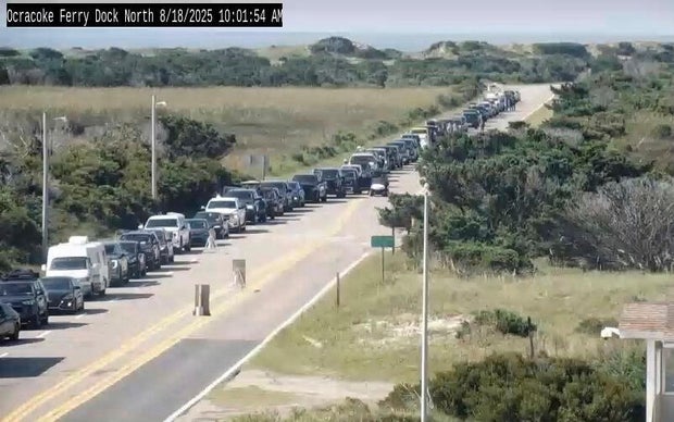
Holly Andrzejewski hadn’t yet welcomed her and her family’s first guests to the Atlantic Inn on Hatteras Island when she had to start rescheduling them, as the storm threatened to whip up wild waves and tropical force winds. Andrzejewski and her husband purchased the bed-and-breakfast, known as the oldest inn on the island, less than a week ago. By Monday they had brought in all the outdoor furniture and made sure their daughter and her boyfriend, who are the innkeepers, had generators, extra water and flashlights as they stayed behind to keep an eye on the property.
“It’s just one of those things where you know this is always a possibility and it could happen, and you just make the best out of it. Otherwise you wouldn’t live at the beach,” said Andrzejewski, who will also remain on the island, at her home about a 15 minutes’ drive away.
The evacuations on Hatteras Island and Ocracoke came at the height of tourist season on the thin stretch of low-lying barrier islands that jut into the Atlantic Ocean and are increasingly vulnerable to storm surges. In 2019, Hurricane Dorian caused record amounts of damage in Ocracoke. Last year, Hurricane Ernesto stayed offshore but created high surf and swells.
Tommy Hutcherson, who owns the community’s only grocery store, said the island has mostly bounced back. He’s optimistic this storm won’t be as destructive.
“But you just never know. I felt the same way about Dorian and we really got smacked,” he said.
With Hurricane Erin, there are concerns that several days of heavy surf, high winds and waves could wash out parts of the main highway. Some routes could be impassable for days.
Tropical storm conditions threaten the coast
Ocean conditions are dangerous off the Outer Banks and the East Coast.
Storm surge warnings, tropical storm warnings and tropical storm watches are in effect along the North Carolina and Virginia coastlines through Thursday. Tropical storm conditions were expected to arrive in parts of the Outer Banks late Wednesday or early Thursday, said CBS News meteorologist Nikki Nolan. Similar conditions were also possible along the Virginia coast and Bermuda on Thursday and Friday.
Communities in those areas have been warned to brace for potentially powerful winds of up to 45 mph, with higher gusts, and storm surge that could rise between 2 and 4 feet above ground in vulnerable areas, according to the latest forecasts.
“The combination of a dangerous storm surge and the tide will cause normally dry areas near the coast to be flooded by rising waters moving inland from the shoreline,” said Nolan.
In the Outer Banks, forecasters said Erin may bring 1 to 2 inches of rainfall starting Wednesday afternoon and continuing into Thursday. They expect conditions along the coast of North Carolina to deteriorate by Wednesday evening.
Between 60 and 70 swimmers were rescued Monday in the coastal North Carolina town of Wrightsville Beach, which is near Wilmington, according to the town’s fire officials. There were no injuries or fatalities recorded.
“Don’t go in the water”
Beaches along the East Coast have closed to swimming, citing rough waters. The National Hurricane Center said in an advisory Wednesday that people “are cautioned against swimming at most U.S. East Coast beaches due to life-threatening surf and rip currents.”
New York City beaches and multiple communities on the New Jersey shore banned swimming because of dangerous surf conditions and strong rip currents.
“I would just say to you, flat out, don’t go in the water,” New Jersey Gov. Phil Murphy said Tuesday. “The fact of the matter is going in the ocean for the next number of days is something you’ve got to avoid.”
The National Weather Service issued a high rip current risk through at least midweek. Wave heights are expected to reach eight to 15 feet, with conditions worsening as the storm moves closer.